DAY 0 – 22 July 2019 – Welcome back! As I mentioned a year ago when I closed out the Darwin to Adelaide trip Blog, we were thinking of doing a similar trip to Perth from Darwin via the Kimberleys. We start tomorrow. We have spent three weeks with the family and today we are driving up to Brisbane for our early flight to Darwin Tuesday Morning. We will pick up our Britz Frontier Campervan right after we land and start out towards the Kimberleys. First night will be in Noonnamah just a short ways from Darwin.

We upgraded to the Frontier for more personal space. We are flying directly back to the States from Perth and we are dragging all our luggage with us all the way. Additionally, we found the Smaller Campervan to be more work than what we wanted to do. With the Frontier we will have more space, less work … perfect combo for a relaxing vacation.

The plans for the ~3000 mile/5000 kilometer trip are to go South to Katherine, then West and South on Highway 1 all the way to Perth, turn in the Camper, rent a car, drive down to Margret River for a couple nights, then back to Perth for our flight back to the States. Lake Argyle, The Bungle-Bungles, Wolf Creek Crater, Camping at several Outback Cattle Stations (they don’t call them ranches here), Derby, a fastboat ride through the Horizontal Falls, Broome, Port Hedland, Monkey Mia, Coral Bay, Hamelin Bay, Shell Beach, Margret River and Perth. You can look, them up on the internet or wait to read about the, here … or both.
We are in the middle of Winter here so the weather is cool (60f/20c) much like Tampa in the Winter. As we go North it will be much Warmer ( Mid 80’s f to low 90s/30-35c) from Darwin to Port Hedland I expect to wear shorts, t-shirt and flip flops. Once we get down to Perth it will again be cooler, and even more so in Margret River (more luggage)!
Nancy has the route all planned out, research done on each area we go to, and ready to guide me along.


DAY 1 – 23 July 2019 – We made it out of Brisbane and into Darwin just fine … a 4.5 hour flight that was nearly on time. Took a taxi to the Britz Camper Rental place, picked up our camper and we were on our way. Noonamah is just under 20 miles/ 35 Kilometers South of Darwin so we had a short drive. We stopped along the way at a Woolworth’s Grocery store and bought some provisions to get us started. We got to the Campground, set up the camper … a little, and proceeded over to the Noonamah Road House Tavern for dinner. We got back early, did a little more arranging, and are calling it a day. Noonamah is just a very small community near the A1 (Stuart Highway) that the road house is named after. Road Houses are like truck stops in the U.S. Some have Taverns and Restaurants, some just have convenience stores … I’m just glad they have them. All Good so far. Traveled so far 35 Kilometers/20 Miles.
DAY 2 – 24 July 2019 … Got an early start and proceeded South to Katherine. We had covered much of this area last year when we did the Darwin to Adelaide trip so we zoomed right along. Only thing that changed was that the highway department was burning the brush along the road. I believe they do this every year to keep the underbrush from taking over. Anyhow, there were some areas where you had to slow to a very slow speed due to poor visibility. The result is a Smokey the Bear Nightmare view!
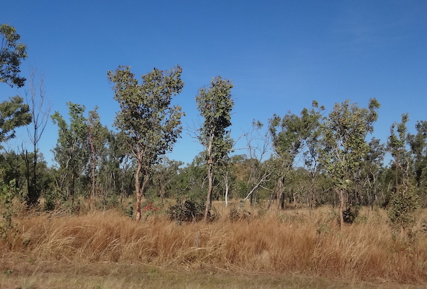
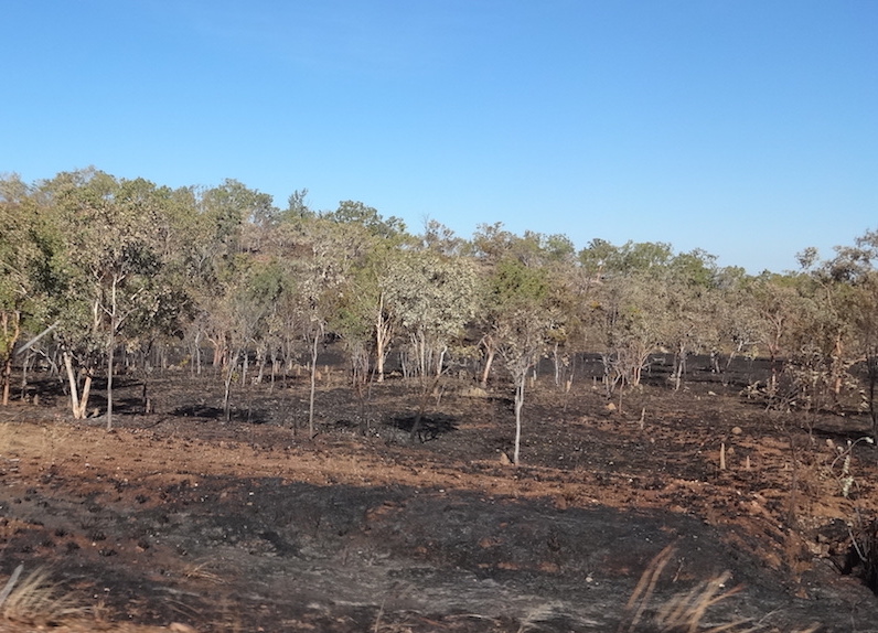

Controlled Burn Along the Road
We made it to Katherine in good time and decided to press all the way to Kununurra and stay there two nights vice staying at a road side camp half way there. It turned out to be an excellent idea as there is a 1.5 hour difference between the time in The Northern Territory where Darwin is and Western Australia, the State that covers most of the western half of Australia. I explained the states and territories in my Darwin to Adelaide post so if you want a civics lesson on Australia you can consult that.
The drive from Katherine to Kununurra was, at first, quite mundane. Trees, brush, trees, dirt roads .. did I mention trees? However we soon started to notice things were changing. There are many large Cattle Stations in this area and in amongst the trees we started spotting herds of cattle. Big herds, little herds, some walking, some just hanging around … but definitely many cattle.
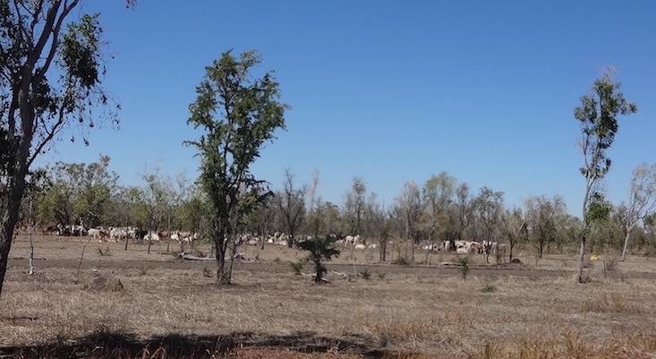


Open Range Cattle 
Another interesting feature we noticed were the different kinds of trees. There are always the scrubby small trees that grow all over the Outback but there were also tall bushes with pretty yellow flowers, Eucalyptus trees, palms, and the unusual Boab tree that looks like a tree growing in a vase or pot. We have seen them no where else but here in Australia and in Africa in the Serengeti and Masa Mara. Some must be quite old as they appear to have been here since the dirt was new.


We passed through a very large National Park called Judbarra/Gregory National Park. The terrain became more dramatic, large sections of granite and Basalt, huge Mesa’s, and stunning scenery. Then to top everything off, the Victoria River runs right through it. In the later Winter most streams, rivers, waterfalls, etc dry up in Australia and they are just dry beds and rock faces. However, the Victoria was still going strong which provided a very impressive scene to those passing over and along it.


When we stopped at the Victoria River it was at a Roadhouse/Campground that sat right next to the road and bridge that spanned the River. So we parked at the Roadhouse and walked out onto the bridge to get the pictures of the River you see above. A Road Train passed us, this one was hauling cattle. These Road trains consist of up to four trailers (Max Length of 183 Feet) and can have as many as 60 tires. They move right along and I doubt they could stop very quickly. Very common on most roads in Australia. I also took a snapshot of the campground to give you a feel for how they look. There were also some interesting trees with white bark as we walked out so I have included them.


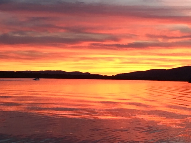
Then we finally made it to Kununurra, found the campsite, checked in, set up camp, and walked to a nearby restaurant for dinner. There is a very large lake here called Lake Argyle. It is the largest Man made lake in Australia. Next to our campsite and by the place we had dinner is Lake Kununurra. We enjoyed a beautiful sunset during dinner.
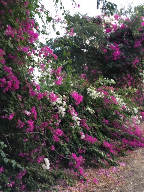
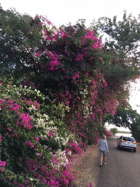
In closing for today I’m including a couple pictures of some unique Australian campers we saw today as well as a shot of some of the Bougainvilleas that are growing here in our campground. The camper is working out well. We had a very long day driving today but will be able to enjoy two days here instead of one. Tomorrow we are touring Lake Argyle and driving up to Wyndham, a small mining town farther North. Traveled today 780 Kilometers/470 miles … total so far 815 Km/490 miles.
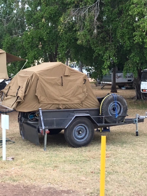
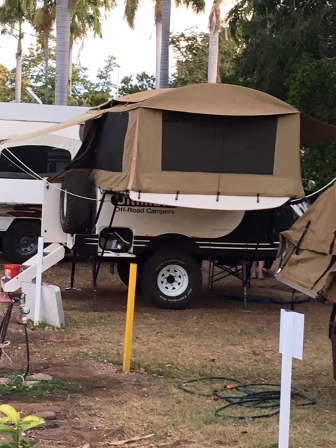

Pop-Up Camper and Ute Top Tent 
DAY 3 – 25 July 2019 – What was supposed to be an easy day turned into quiet the day! Slept in a bit … had some coffee. tidied up the camper, broke camp (problem with a Campervan … you take your camp with you every day!) and started out for Lake Argyle. Driving along the camper felt a bit sluggish … checked the emergency brake, tried to shift up manually, watched the wind … nothing seemed to help. So I pulled over and checked my tires. Sure enough, the inner dual in back had no air 🙁 I checked all the equipment they gave me and I had everything I needed to change it; checked the spare and it was full of air. Getting ready to jack it up, I thought I would loosen the lug nuts while the wheel was still held fast by the earth. Some toad had tightened them with an air wrench so tight that the little tools I had wouldn’t touch’em. So we headed back into town. We were about 20Km/12Mi from town so I limped in. Finally got the help line lady on once we were back into cell service (not much available in the Outback) and she told me to take it to a specific tire shop and get it fixed … so I did. Even after they got me changed quickly, we had already lost over an hour so it was back on the road (without a spare till they could get it fixed) and back to Lake Argyle.
Lake Argyle was very impressive. Built in the 1970’s to help irrigate agriculture it is huge. It is also nestled into tall craggy ridges of rock, trees, and various plants making for a picturesque view. We were only able to see a small part of it near the dam, but as you can see it extends way out into the hills. At the top of the map is where we camped and had dinner.

We are doing a lot of doubling back today. First drive part way to Lake Argyle, then back to town to fix the flat, then back out to Lake Argyle, then back to town on the way to Wyndham which is 100 kilometers (60 miles) from Kununurra. Wyndham is supposed to be a mining town that has lost it’s mining and is just kind of left there. So we drive out to see it. It is located close to the Timor Sea and is a port. It actually is a bit inland at the convergence of five different rivers. One of the main rivers is the Ord which feels Lake Argyle.
Wyndham was a bust. Really not very much left there but a small community trying to survive but really has little to hope for. The town’s historical society has a small museum, there is a port with some old trains to see, and some left over construction equipment. It’s not a bad place, just in the wrong place. There are some interesting Tidal Flats as you come into town, and the city has built an impressive pier that you can fish from or launch your yacht from. Also an old cemetery and the largest crocodile I have ever seen. There was a huge Boab Tree in the city center that Nancy took a Photo of. Anyhow, here’s some shots we took while we were there.


So back to Kununurra, pick up our new spare tire, fill up with fuel, get some dinner, and back to our campsite for the evening. 410Km/246Miles today. Total traveled 1225Km/736Miles.
DAY 4 – 26 July 2010 – Slept in a bit, had some coffee, emptied the waste water and refilled the fresh water. Heading out into the Kimberleys and expect less Cell coverage, less internet, less water, and lesser accommodations. Today’s destination is the Bungle Bungles Caravan Park which is just off of the Great Northern Highway on the way out to the Purnalulu National Park that hosts the Bungle Bungle Mountains. Not too long of a drive, about 250 Km or 150 miles. We have booked two nights there, tonight and tomorrow night. Early tomorrow we take a tour (bus and hiking) through the Bungle Bungles. More on that after the tour tomorrow.


The trip was interesting yet pretty much the same. Lots of small trees, bare ground, rocky hills, although the rocks seem to be getting larger. Stopped at The Doom Doom Road House and had a sandwich for lunch. Took a picture of another road train, then rolled into the campground. I can describe the campground with one word … Dirt … not dirty but lots of dirt. Ran by nice people and offering all the camping amenities it is a good place to stay cuz the National Park Campground is another 50Km in on a washboard dirt road … no thanks. They serve dinner in a large tent next to an open bonfire. Very congenial atmosphere. Had a friendly Bull stop by … just checking out the campers. Here are some shots of the campground. Traveled today 250Km/150 Miles … Total traveled this trip 1475 Km/886miles.
DAY 5 – 27 July 2019 – The day for the Bungle Bungles … But first, after I closed last night we heard a great racket overhead and took a look and there were hundreds of white Cockatoos flying over the campground and landing in a nearby field. We walked over to watch them and it was a sight to behold. Then, just as the sun was setting they started to flight up into the nearby trees to roost for the night.
This morning was an early up for us because we were catching a 06:15 bus tour of the Bungle Bungles. We were up a bit before that for a coffee and again the Cockatoos started up with their screeching and noise. Looking out we found them settling in a tree right by our camper. Right behind them was a very impressive Australian Sunrise.
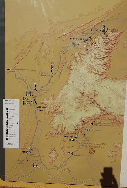
Okay!!! Time for the Bungle Bungles. Our tour starts with a 90 minute ride in a four wheel drive, heavy duty bus over 50 kilometers of rocky, dusty, narrow, winding cow track. The first 30 Kilometers is over private property, then into the Pernululu National Park. The Private property is part of a very large Station that basically surrounds the National Park. The Molly Downs Station. Consequently we see small and large bunches of cows and bulls along the way. The terrain goes from flat and bushy to hilly, hillier, and rugged and bushy. Then you begin seeing outcrops of dome like formations of sandstone in red and black layers. The unique shape and size of them is what makes them the Bungle Bungles and they cover several thousand acres of land. We stop briefly at the reception center for a fresher upper then press on.


Our Bus 
A Ute
The only people you see in many of these parks are people who own four wheel drive pickups (Utes), or off road vehicles. The roads are rugged and most rental companies won’t let you go off of the paved roads. Our first stop after the reception area is at the Elephant rocks.
Pretty clever how these Australians name things! We pressed on to The Piccaninny Picnic Area where we had morning tea and set off on a five kilometer walk through the Bungle Bungles. The destination was the Cathedral Gorge but we saw several others along the way.


Morning Tea 
Mushroom Rock 
The Bungle Bungles 

Morning Tea (Instant Coffee in a Tin Cup) 


A 7 Foot Termite Nest 

An Interesting Termite Nest 

A Tree Growing out of the Rock 

Entrance to the Cathedral Cavern 


Piccaninny Creek Bed 
Looking for Whip Snakes 


A Termite Statue 

Rock Pools Carved by Flood Waters 

A Long Way In 


Cathedral Gorge 
Looking Up from Cathedral Gorge 


A Fish Fossil? 
When we returned from the Cathedral Gorge Death March we had lunch. The back end of the bus has shelves and refers so we had a nice lunch. Wraps, watermelon, orange and apple slices, water, or juice … and a rest.

This concluded our tour of this side and end of the park. We now drove all the way to the bottom and then to near the top on the other side to the Echidna.
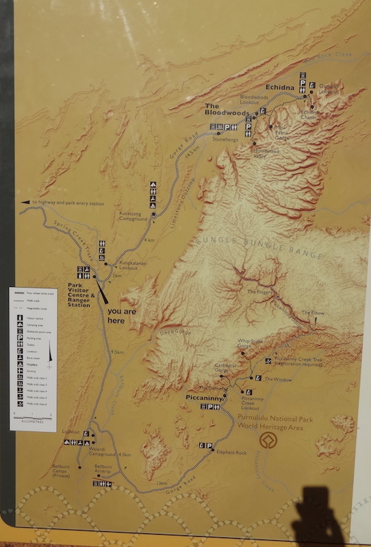
This turned out to be the most difficult walk even though it was just about a Kilometer in and another back out. What made it so difficult was that most of it was following a dry creek bed that was filled with rocks … all round, some like baseballs, some like soft balls, and some like bowling balls. Very insecure footing that required you to constantly stare at your new step. If you wanted to view something or take a picture you had to stop, stand in place, and look around. Walking without looking where your feet were going was extremely hazardous. Towards the end were several narrow passages, steep steps, and boulders. All just to say you made it to the end. The views were astounding.


The Tight Squeeze 


Nancy at The End 


The Path 
Composit Rocks
So we made it in and all the way out … very few broken bones and most of us got back. Back into the bus for one last stop to view the Osmand Range from the Kungkalanayi Lookout (try to say that after a couple beers!)
So that ended our Tour of the Bungle Bungles … except for the 50 kilometer ride back which was a “90 minute ride in a four wheel drive, heavy duty bus over 50 kilometers of rocky, dusty, narrow, winding cow track!” It was nearly dark when we got back to the campground. We had been gone for 11 hours. Everyone had a good time, almost everyone survived, and we were all treated to a delicious beef stew dinner with an apple crisp with ice cream desert … it just does not get any better than that. We saw the only live kangaroos we have seen so far on the trip back. It was late afternoon and the sun was setting and that is when they usually come out. We saw eight. We slept well that night. As I mentioned, the campground has a big bond fire and everyone sits round chatting. As always we met many interesting people. For being billed as a remote area, this, as was the Alice Springs area, is packed with campers, hikers, old folks escaping the cold in the South, young folks taking a year off with their family to see Australia, and even once in a while, a stray American. Haven’t seen Crocodile Dundee yet! No Driving today and still at total traveled this trip 1475 Km/886miles.
DAY 6 – 28 July 2019 – Today was a drive day and we were going to drive to Halls Creek and pick up a flight over the Wolfe Creek Crater. This crater was created long before any of us were born and was discovered long before any of us were born. However, it is a very large crater that was the result of a meteor strike. Pictures of it look like a big eye but it is really just a large crater in the red dirt and rocks with trees growing in the middle.

We are not going to take the flight because the charter outfit we were booked with changed the times making it impossible for us to both go on the flight and get to where we are supposed to be by evening. We cancelled the flight and and our reservation at Larwana Station campsite and are driving to Derby some 630 kilometers East and North. The drive is interesting as the terrain changes to quite remote then back to bushes and trees. We passed through and stopped at both Halls Creek and Fitzroy Crossing for gas and a break. Both are cited in tour books as interesting settlements with beautiful terrain, hiking trails, and rich history. You need to go there to be the judge of that. We found a couple gas stations, some generator sites, a few homes, and a bunch of campers. Of course there is the ever present Termite mounds standing guard along the road. The sentinels of the highway. Following is a series of pictures taken along the way. We drove 650 Kilometers to day or 390 miles. Total traveled this trip 2125 Km/1275 miles.

The Red Earth 

Termite Mounds 
Long Lonesome Highway 


Looks like the Western U.S.
DAY 7 – 29 July 2019 – A down day for the weary. Did some cleanup at the camper, did a little wash, did some shopping, tried to do some internet work, etc. The camp is quite nice but no internet to speak of. Meeting many interesting people. It is amazing how and why some of them are traveling. Again, many retirees seeing Australia with their campers and motorhomes … They are called the “Grey Nomads”. They don’t go very far each day but spend a lot of time socializing. They are often on the road for months. Anyhow, we had a good day. No pictures. Total traveled this trip 2125 Km/1275 miles.
DAY 8 – 30 July 2019 – Today is our trip to the Horizontal Waterfalls. They aren’t really a waterfalls abut rather a rush of water created by the large tides in this area. Second only to Nova Scotia, the tides here can exceed 14 feet in a couple hours. In the Horizontal Waterfalls area, the water passed through two narrow passages which cannot handle the volume of water the tide presents or pulls back. Consequently a difference in level occurs on each side of the gap creating a wall of water on one side that “Falls” to the lower level on the other side. The difference in level changes with the Moon’s position and we caught it kind of in the middle so the change was not overly dramatic. None the less, it was exciting to see the Falls and run them in a powerful speedboat. The skipper would make several runs through the gaps ensuring everyone enjoyed them. The tour was exceptionally well done and organized. We were picked up at eight and separated into different buses based on which airplane we were assigned to. Driven to the airport, we were briefed, weighed, and boarded. The flights took about 45 minutes and were low enough to enjoy the mudflats, streams, and mangroves along the edges of the peninsula. We landed in the water next to a transfer barge that was our “Home Base’ for the day. Once briefed on the boats, we were taken for our first ride to the falls. The tide was going in. Shot the two narrows several times, got some pictures, listened to some stories about the narrows. Then back to the home base for morning tea. After Tea we fed the sharks, had a chance to swim with them (not me), and took a cruise up one of the main tributaries, Cyclone Creek. Then back to view the Falls in a high tide state with no movement. Back to the Base for lunch and a rest. Our last event was back to the Falls for the tide coming out. I tried to capture the falling flow at the edges of the gaps. Guess you had to be there but it was exciting and the skipper handled the boat perfectly making it an exciting adventure. Some of the younger folks put their hands in the air like they were riding a Roller Coaster. (I couldn’t, I was taking pictures). Finally back to the base, transfer to planes, and fly back to Derby. Exceptionally well done. Very interesting … a very good day.


Our Pilot! 


First Sighting of the Horizontal Waterfalls 


Our Destination 
The Gaps 


The Pivot Point 
Horizontal Waterfalls 
De Plane 
De Boat 


Tide going In 


Living The Dream 
The Speed Boat 
1200 CC Of Motor 
Feeding the Sharks 
Here They Come 


Don’t Forget Me!! 


One At A Time Please! 
I’m Still Here 


Tea Time 

Going Up Cyclone Creek 
Hotel Docked on Cyclone Creek 


See the Croc? 


High Tide – No Flow 


Lunch 


Tide Flowing Back Out 


OutFlow 


Once we were dropped off at the campsite Nancy and I walked to a nearby restaurant for dinner and took a picture by an old Boab tree and of some Gayla Birds.
No Driving today. Total traveled this trip 2125 Km/1275 miles.
DAY 9 – 31 July 2019 – Another day on the road … but not too far. We kicked the dust of Derby from our shoes and left fairly early in the morning. Derby was an interesting place but again, struggling to survive. There is a large prison there which I would assume to be one of the major employers for the area.
One of the places we stopped at on the way out of town was the Prison Boab tree. History has it that local colonials known as Blackbirds would go out in the bush and capture young Aboriginal men and bring them to Derby to be sold for labor in the Pearl Industry. One of the stops was the Boab tree where the captives were held. They were put in through the small gap and remained there through the night.

Some History (The poster was faded … Sorry) 
The Gap in the tree (Note the size of the man on the other side). 
The backside of the tree 

Some background on the Boab
Sorry if you can’t read the posters very well. They were very faded. I’m sure Google can provide more background. Boabs are found in Australia and Africa and six of them in Madagascar. Some are estimated to be over 1500 years old.
There are some words about Derby and Broome (Today’s destination) in yesterday’s post by the map.
Derby has a very high population of Aboriginal people and many have no employment. You often hear local Australian’s advising to avoid the area due to troublesome locals. This applied to Halls Creek and Fitzroy Crossing as well. We had no problems and Nancy bought a hand carved Boab seed pod from a couple that were carving and selling them. The Pods are quite large!
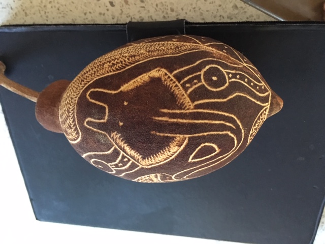
Aboriginal Carvings on Boab Tree Seed Pod 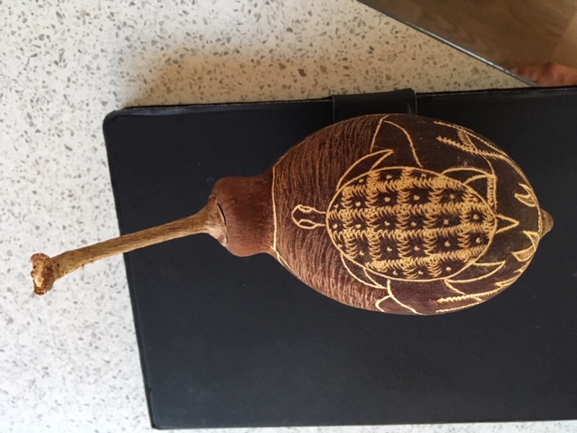
Carved Boab Tree Seed Pod (On My iPad)
We left town and drove out on the Gibbs River Road a ways just to see what it was like. Because we are driving a rental camper we are prohibited from driving on anything but paved roads. The Gibbs River Road runs kinda parallel to The Great Northern Highway but is not paved. It is the place where young Australian men take their goochie rigged 4 WD Utes to prove their manlyhood. Its 600 miles of washboard roads interrupted by washouts and other Utes. An amazing number of people drag their pop-up trailers and caravans across the Gibbs River Road just to see it. Me, I’m okay with the motorhome and a paved highway.
Again, the road from Derby to Broome was filled with scenery of trees, termite mounds, buttes, ridges, rocks, and a couple of creeks. We stopped at Cockatoo Creek and took some pictures because it had some cattle and some Sand Hill Cranes hang’en out.


Sand Hill Cranes 


The rest of the trip was good. Stopped at a couple Roadhouses for coffee, gas, and snacks. Made it to Broome just after noon, spend some time at a local information office getting ads and flyers. Then checked into our campground … right by the Pacific Ocean.


The Long and Lonesome Road 
Boab Pods 
Boab with Leaves and Pods 
The Pacific at Low Tide
Tomorrow is touring Broome and what it has to offer. China Town, Whale watching, Beaches, Camel Rides … we will see what happens. Traveled today 280 Kilometers or 170 miles. Travel so far 2405 kilometers/ 1440 Miles.
DAY 10 – 1 August 2019 – Happy August!! Spent the better part of the day enjoying Broome. Got up and had a cup of coffee and decided to walk to a nearby Cafe, which is also next to the ocean, and have a Latte and a sweetie. Saw a couple dolphins playing near the shore and enjoyed a high tide. Then packed up and drove to several local sites. A large pier where we saw some interesting shore rocks, went to Cable Beach which is THE place to go in Broome (very nice but the Camel rides were not there) and then over to China town for some shopping. Had a good day so far.

The Pier 
High Tide 
Cruise Boat at Pier 
Our Crowded Campsite 
Beach by Racetrack 
Pier 
Rocky Shore 

Driving on Beach 
Local Boaters 


Cabel Beach 


China Town 

World’s Largest Pearl 
Broome is a more modern city (It even has a McDonalds) with varied businesses and activities. Founded by the Pearl industry it continues to be one of the more successful municipalities in the Northwest of Australia. Tonight we are attending an outdoor City Market that sets up every Thursday evening. It is right next to our campgrounds so we intend to check it out.
It was fun. The market attracted locals and tourist, young and old. Families, singles, and pets. We went over about 45 minutes after it opened and the crowd was building. Foods from many different countries. ***I tell people that the U.S. was the melting pot for Europe and Australia has become the melting pot for Asia*** Art, jewelry, crafts, slicers and dicers (Yes they have them here too), clothes, equipment for picnicking, and food … all kinds of food. Everyone seemed to be having fun and enjoying the evening. It had cooled some and there was a pleasant breeze. Nancy and I had several small helpings from different booths and shared them … and topped it all off with some Ice Cream. Tomorrow is whale watching. Just drove around town a little today so no big increase in milage. Travel so far 2405 kilometers/ 1440 Miles.
DAY 11 – 02 August 2019 – So today we are off on a whale watching cruise that we found information about at the Information Center. A bit about that … Most Bigger towns and larger have Information Centers that are manned by very helpful, smart, wonderful people. They know a great deal about, not only the town they are in, but the entire area around it. Plus they have racks and racks of maps, advertisements, helpful information about nearly anything to do with the area. We never miss one coming into an area we are interested in, and have never been disappointed. Smaller town have “Information Bays” which are usually a pull off just outside of town that has a big map of the city and most of the major activities highlighted on it … just no helpful people. We discovered the information centers early in our Australian travels when we needed a map. Here was a place call the information center so I stopped. There was a delightful gentlemen there who not only provided a map but entertained us with stories of the area for as long as we would listen. We have rarely missed one since … they are marked wit a big blue sign with a small italicized “i’ on it. So, back to today … got up, had a cup in the camper then mosied over to the Cafe for a Latte. Saw some wind surfers there … they were very good and entertained us through our latte’s.
Then we we walked out to the from of the camp and were picked up and taken to our Whale Watching Boat. A 42′ Catamaran that was skippered by a very knowledgeable man and hosted by two lovely ladies who ensured we always had something to drink, eat, or whatever. We drove out to the Cat in a strange three wheeled boat (pictured later) climbed on board, and set sail for the whale playgrounds. We sailed from a beach called Gantheaume Point and sailed about three miles out to see. We soon started seeing spouts of spray into the air and knew the whales were about.

On Deck 

Gantheaume Point 
Gantheaume point Beach 


Thar She Blows 


Two Guys Hang’en Out 


Wave to the Nice People 


It Was This Tall! 


Little Baby Tail 
Mom & Baby 


Bye
Some were far away and some were close to the boat. You never knew when they would surface or roll over, or spray so you had to be on your toes. We saw maybe ten or twelve different whales, some pairs of young males, some mothers and calves. Some were shy and swam away, some kinda played around. Two things you can count on when photographing whales 1). They will always be somewhere you are not looking, and 2). They only show up when you cater goes to sleep or is turned off.
So, The day got late so we headed in and watched a beautiful sunset as well came back in. A very nice day.

The Whale Watchers 


The Last Wink 

A Big Party Boat Coming In 


Our Boat 
The Three Wheeled Boat 
Mud Flats 
Our Day ended, we got back to camp quite late, ate some stuff in the camper and called it a day. Still no driving today so we are still at … Travel so far 2405 kilometers/ 1440 Miles.
DAY 12 – 03 August 2019 – Up early, take the camper down, have a coffee, drop off the keys to the bathroom, and off we go from Broome to Port Hedland. This will be the most desolate part of our trip as there is NOTHING for a little over 600 kilometers or 360 miles. That’s not entirely true as there are two little Roadhouses along the way … Sandfire at 310 kilometers from Broome and Pardoo which is another 160 kilometers from Sandfire. We have filled up with gas, have plenty of water, the tires are all inflated, and we are off.


Brush, New and Burned
That’s what nothing looks like folks. Brush, small trees, grass, a few rocks … not even a lot of Termite Mounds. The road follows along the coastline anywhere from 2 to ten kilometers away from the water. Most of the area we traveled was once a sea bed but the Pacific has pulled back and thousands of years ago plants started to grow here …part of that Global Warming thing I guess. Many sections had been burned in some years past so you could see the different phases of recovery the plantlike was going through. Several Stations, quite few cows, saw one Wallaby. Sandfire was a very small place with a lot of gas pumps … no one wanted to run low on fuel .. didn’t have much else to offer. Pardoo was a little better but still small. We got to Port Hedland which, 10 years ago was a thriving industrial Port but today is struggling to survive. The iron mines keep it useful but not like before. Many vacant housing areas where workers used to live. Salt, Iron Ore, shipping, etc. Traveled today, 630 Kilometers/380 miles. Travel so far 3035 kilometers/ 1821 Miles.

Salt For Export 
Ore Train Moving to the Docks 
DAY 13 – 04 August 2019 – We are leaving the coastal area this morning and heading straight south to a National Park that has some gorgeous Gorges. The coast continues much like yesterday and we will pick it up again in a couple days. Here’s a map of where we are in Australia, going South from Port Hedland to Karijini National Park … That’s the orange line on the map. From Tom Price (where we are staying tonite), and yes, that is the name of the town. We will be heading west back out towards the coast and staying at Nanutarra Roadhouse tomorrow night (The green line). Our plan is to spend a couple days in the Exmouth/Coral Bay area.
The trip to the park was very interesting for a number of reasons. First of all, the road was loaded with Road Trains hauling ore, petroleum, machinery, and supplies to support all the mines in the area. They haul the ore up to Port Hedland to be loaded up on freighter and shipped to Japan or China for processing into steel. Secondly, the terrain changed from flat scrub brush to rocks, then hills, then good sized mountains … which the mining people were tearing open and ripping out the ore. Lastly, we gained in altitude above sea level. Tonight, at Tom Price, we are at about 3000′ above sea level, the temps are in the 60’s and it feels great!

Truck train .. up to 5 Trailors 
96 Wheels on this baby! 
It Takes a While to Pass Them 
Coming and Going 

Growing Terrain 

Iron Mountains 


White Barked Tree 
Pinion Type tree 
Mountains
Karijini National Park is very nice. Even tough there were very large areas that had been burned, the terrain and trees were beautiful. There were two different Gorges; Dales Gorge which had a waterfall and a pool and Joffe Gorge which had a big Falls. We went to both of them and were not disappointed.


Pool at Bottom of Gorge 
Close-up of Swimmers at the Pool 


The Falls 


Termite Mound 
Natural Occurrence of Blue Asbestose 

The Gorge 


Mountain Grass
It is difficult to capture huge natural scenes with a camera. The eye takes in so much more. Next was Coffee Gorge and Falls and the way there. The first Gorge was on the East side of the park, this one is on the North West side of the park..


Coffee Gorge 
People Climbing 

The Falls 


We went to our campsite and set up. We were sitting outside and were visited by a bunch of birds that looked like pidgins and anther bunch that are called Galah Birds … they are a kind of parrot. Very pretty.

Galah 

Pidgen with a Peaked head 
Two Galahs in a tree 
Don’t Mess With Me!!
So that’s it for today. Everything went well. Met some interesting people … then we do almost every day. Easy day tomorrow. Traveled 530 Kilometers today, 318 miles. Travel so far 3565 kilometers/ 2193 Miles.
DAY 14 – 05 August 2019 – As I mentioned and as the map shows today we were to drive from Tom Price to Nanutarra. So we did. An interesting drive as the terrain went from the upper hills back down to the coastal plains. Many changes in the land, vegetation, and temperature. It was 8c this morning when we woke up that’s about 46f. Fired up the heat pump for a few minutes so we could enjoy our coffee without shivering. Anyway … got off to a good start and had a good trip … about 360 Kilometers or 216 miles. I will put up some terrain pictures but they are like so many of the others. We did come across a couple of interesting displays of mining equipment. First in Tom Price was a dump truck they used in the iron mines.


Some Factoids 


Next to our Camper!
We drove for a couple hundred kilometers and stopped in a town named Paraburdoo. Had some lunch there and on the way out of town found another dump truck.

Even Bigger 

Something I wanted to clarify here before I get too many complaints. Since we were in Broome we have been on the Indian Ocean. Before that we were on the Timor Sea and over by Cairns was the Coral Sea. The Pacific is on the East coast of Australia, some call it the South Pacific. Where were these people during the Geography Conventioned that named all this stuff!! Anyway, one last thing … flooding. Australia has two seasons … Flooding and dry. During the dry season it does not pay to walk out to a scenic lookout to see a falls cuz there is not one there. In the rainy season you can’t get to it because its all flooded. Very common throughout the country are signs warning of flooding and measuring sticks along the road showing you how deep the water is. You can try to drive through if you like. The amazing thing is that these signs are in big flat areas so the flood must cover hundreds of acres. Many roads have signs indicating if they re open or not and if they are not it is most likely because of flooding. Another hazard is cows and livestock. You see many signs warning of loose livestock and you see quite a few dead cows along the road that didn’t make it.

A Cow and her Calf
I mentioned trees earlier. Two kinds of bushy trees tend to grow in these coastal areas. Both look like pinion or scrub brush but I am not sure what they are called. And then there is the Eucalyptus that seems to grow everywhere.
Here’s some scenery from long the way. Enjoy. Travel today 360 Kilometers. Travel so far 3925 kilometers/ 2193 Miles.
DAY 15 – 06 August 2010 – Shame on me but I missed posting today … actually we were out in the country at a Station Stay and although they did have some cell service, I could not get enough bandwidth to update the blog. Not to say we didn’t’t have a good time because we did! I’ll tell you all about it in a second. First, the trip from Nanutarra Road House to Bullara Station. Pretty boring, mostly coastal plains with intermittent brush etc. I will not post any more pictures of the brush unless I think it is somehow different. We climbed out of Nanutarra and the landscape was mostly grass and brush but everything was a bit greener so was more pleasant to look at. Did not see many Termite Mounds, which was unusual but they are still out there. Towards the end of the trip (we actually drove pst the entrance to Bullara) we drove up a Peninsula to a town called Exmouth.
Not many people know how it got it’s name but I do and I will tell you. As you will see in the pictures, Exmouth was actually settled by the U.S. Navy. During the height of the Cold war the U.S. had a big fleet of Nuclear Submarines that ranged all over the world and would remain underwater for months at a time. Well, the Navy needed to talk to them so they established Very Low Frequency (VLF) transmitter sites in strategic spots around the world and these radios would put sound waves into the water that would carry vast distances to the subs. I, digress, back to Exmouth. Anyhow, when the town was first being built to house the Naval personal that ran the radio site, the commanding officer, at a staff meeting (the Navy has a lot of those) one day, announced they needed to name this town they were building. They pondered and discussed for some time and finally, in Navel tradition, decided to table the issue for further action at a later date. Everyone complained that they needed to refer to the town in some manner so the CO said we’ll just put an X in front of the name the Navy uses most and call it Mouth. The Navy never did get round to coming up with a name and the Aussies felt XMouth was a little raw so they put an E in front of it … thus … EXMOUTH. The Royal Australian Air Force has since opened a base on the peninsula and, not having problems with decisions, immediately named it Learmouth RAAF Base. Now you know too!
Exmouth was built by and for the U.S. Navy personnel who cared for and ran the transmitter site as well as the Australians who supported them. The town is now a big tourist area with the Ningaloo Reef running down along side the peninsula and Cape Range National Park occupying much of it.


The VLF Antenna Field (The Tall Towers)
On the other side of the Peninsula there was a lighthouse with a story and more beaches. There are also commercial tours available here like diving, snorkeling, boating, etc. The temps were low and the wind was up so we decided to forgo the tours.


How the Lighthouse came to be 
About the Town 
An Interesting Story 
There was also a Radar Watch station here during WWII 
Campground By the Lighthouse 
Villas you can rent above the Campground 
Wreakage of the SS Mildura
The beach one the other side was especially nice. We drove down to the wreck site and went for a walk … looked at some beach objects, etc.


Whale Shark … Largest Fish in the World
Leaving Exmouth we returned to Bullara Station where they offered overnight stays (camping). The place turned out to be a great experience. We checked in, got settled and took a little walk and met one of the local sheep, toured a couple buildings, and just kinda got oriented. We returned to the camper for a few minutes and then took our lawn chairs (they come with the camper) over to the fire pit where they had started a bonfire. There was a gentleman there who was getting ready to give a little talk about the Station and he had just made Damper (fire baked bread in big Loaves) for everyone. He cut the Damper up and it was passed out while he spoke about the station, it’s size, number of cattle, etc. Very interesting, and the Damper was good too. Nancy talked some other people out of some jelly for hers … mine was fine just plain (I got a piece of the crust!). Then we mingled with the other folks around the bonfire for a while and soon it was time to go to the cookhouse for dinner. The ad we saw for the Stay indicated they served dinner sometimes so I asked when I made the reservations if the night we were staying had dinner available … they said it did so we signed up for it. Turns out it’s dinner with the staff. What a delightful crew and dinner. Colleen, the chef, made an excellent dinner, the company was awesome, and we had a great evening. Many service type businesses here hire young people who come to Australia on work VISA’s. They work for a certain number of months then they are allowed to stay and travel for a time. With us, at dinner, were two young ladies from Chili, one from Canada, one from New Zealand, one from Germany, and a lady who helped out at the station, one of the “Cowboys” from the Station, and of course, Colleen. We had a hoot! the food was very good and the evening went by all too fast. On the way home we stopped by to say “G’Night” to the local Roo who was hanging around the camp. She is about a year old and they tell us they stay around until they get about two, then some Handsome, mature Roo hops by and they are off into the bush never to be seen again. Anyhow … A great evening and stay. Travel today 389 Kilometers. Travel so far 4313 kilometers/ 2588 Miles.

The Front Gate to Bullara 
A Local Roo 
Hello 
The Bottle Tree 


Cutting up the Damper 
The Bonfire 
The Shower 
Inside the Shower 
We Were “Special” Guests 
Set For Dinner 
The Dinner Gang 
G’Night Little Roo
DAY 16 – 07 August 2019 – Our Day started of really well. The girls from dinner last night were bragging about their Barista Coffee and Scones they serve at breakfast … so we decided to try them out. They were right … truly good Latte’s and awesome Scones. Biscuit with Strawberry jam and clotted cream on top … mmmmmmM. SO we finally left and drove, across the tidal planes again, to Coral Bay. A Small but very nice little village high on the water. The Reef extends down this far so it was very nice with the multicolored water, white sand, and big sky. We stopped and walked around … very pretty.

Breakfast Setting at Bullara 
Nancy Doing a Route Study 

More Station Equipment 

The Termite Mounds are Back 


Coral Bay 


The Surf through a Telescope 


The LAttee and Scone
Then we pressed on to our destination for the day, Carnarvon. A little seacoast town … bigger than some, with a nice harbor and seaside presence. Carnarvon is famous for it’s production of vegetables. We saw corn, tomatoes, bananas, kale, bay choi, and a bunch (really large fields) of other ones. Had a Latte and a sweetie for mid afternoon snack, toured around a bit, and checked in to our campsite. The campsite is okay and will do for the night. Went back downtown for dinner and ate at the local hotel … met a nice old man who had immigrated to Australia when he was 20 from Germany … 64 years ago. Interesting stories. Here’s some pics from the town.

Carnarvon By The Sea 


Downtown 

Crossed the Trop[ic of Capricorn today …southbound. Getting ready to turn Base to Final with about 900 Kilometers left to go to get to Perth. Couple more days after that but the end is in sight. Travel today 449 Kilometers. Travel so far 4762 kilometers/ 2857 Miles.
DAY 17 – 08 August 2019 – Interesting day, crossed the 26th Parallel twice today; once leaving the Northwest and the second time going North entering the Northwest. The Northwestern part of Australia is filled with little peninsulas that stick out into the Indian ocean pointing Northwest. Consequently we have made several “loops out to the mainland then back uo onto the peninsula to reach our destination. The result is very rewarding as each of them offer tremendous views, sandy beaches, a lot of wildlife, and interesting glimpses of the ocean with little towns sprinkled along the way. Today we left Carnarvan and headed South onto the mainland for about 150 kilometers. Then we turned west and Northwest to track up into the Shark Bay area.

We made three interesting stops. The first was in Hamlin bay where the oldest living Coral in the world is still growing. Call Stromatolites, they are a “Rainforest of Bacteria” that grow in big ugly bumps along the beach. Very interesting;

Entrance to Shark Bay 

Walk to the Stromatolites 


Local Birds Hang’en Out 
This is them 


Next we went to Shell Beach. This relatively large area is made up of nothing but millions of little shells, all white. They are up to 15 feet deep and even formed “Shell Dunes”.


Shell Beach 


Julie’s Dream 


Playing in the Shells 


Shell Beach from Afar
Lastly, we went to Eagle’s Bluff. A Walkway had been built along the steep bank of the shore allowing people to walk along the top edge and take in the views. Incredible water.


They even Have Animals like Manatee’s 


The Land Away from the Beach
So we finally pulled into Denham where we will be spending the night. Nice little beachside town. Have our campsite and will walk downtown for dinner. Here’s some shots of downtown.


Couple of things … we are out of the Outback … I think since we left Tom Price. The area is becoming more and more populated. We noticed there seemed to be many older people traveling so Nancy did a little research. She found that since 2016 people over 58 have flooded the campgrounds with caravans, tents, trailers, and motorhomes due to the cost of living going up. They travel for months at a time, many of them know many of the others so every stay is like old home week. They are called “The Gray Nomads” and are quite like our “Snowbirds”! Most stay in one spot for 3 to 5 nights then press on … some stay in the same place for months. We have met many of them and they all have interesting stories and want to know what we are doing “out here” so we always have a good conversation. Traveled today, 350 Kilometers. Travel so far 5112 kilometers/ 3067 Miles.
DAY 18 – 09 August 2019 – Very Good Day Today. We got up early to be in Monkey Mia by 7:30. Monkey Mia is a little point on the end of the peninsula North of Denham that is a National Preserve for Dolphins. (Pink Route)

They come in from the Ocean, on their own, starting at about 7:45, several times during each morning and kind of play around eating fish and playing … then they leave. Laws have been passed in Western Australia (The State we are in) prohibiting anyone from directly approaching or trying to touch a wild Dolphin. Consequently, Rangers from the preserve come out early and tell all the people who are gathered there above the beach what will happen and what they can and cannot do. The Dolphins came in, at least a couple of them, and we watched them from a pier. Many people stood right next to the water and the Dolphins swam by very close. It was colder than snot with a stiff wind so, having seen Dolphins many times before, Nancy and I left and hit the road.


First Sighting 


Here’s What I was Looking At!! 

Local Pelican Trying to Steal the Show 


Mom & Junior 
Bye Bye
After we watched the Dolphins we went back to Denham and had a coffee and a sweetie to get our bones warm again and headed South for Geraldton, destination for the day. Nancy was studying her maps and books and suggested we do a little diversion to the West and go through a National Park called Kalbarri National Park, then to a town named Kalbarri, then down along the coast to Geraldton. It was a little out of the way but we had time, nothing else on the menu for the day, so … Why Not. The Black line on the map above.
Meanwhile, as we were driving South, back again on Hwy 1 the landscape suddenly changed. There is a plain that runs along the coast that is about 50 miles wide. From Denham to Hwy 1 and South it was quite lush with lots of green bushes that were thick. After we got on one they dried up and the terrain was again the dry scrub brush and red clay. About 75 Kilometers from the turnoff to Kalbarri we started seeing large green fields that were worked by farmers. Others were large and worked but looked like they had been harvested sometime last year. The fields continued to increase in sized frequency and suddenly we were in farmland with sheep and crops. WoW!! It was good to see trees and grass and fat animals.


The Green Green Grass of Home
We were very pleased we did cuz Kalbarri National Park is kinda small but big in vistas. We pulled into one place, Ross Graham Lookout and walked out. Truly impressive. The Murchison River flows through a deep gorge and continues down to the coast. So we did too.


Yellow Flowers
We arrived in the Village of Kalbarri and were pleasantly surprised. Kalbarri was a tidy little coastal village that hosted surfing on the Indian Ocean, resorts, camps, horseback riding, and beautiful views … not to mention cute cottages and impressive homes.


The Surf 

The Village
Last on Nancy’s list of things to see on her diversion was a Pink Lake. Colored by Algi and sea shells it is truly Red. It is called the Hutt Lagoon.
What a sight! That was our last stop on our way into Geraldton and we soon were in town, got our campsite and found somewhere to eat dinner. I forgot to mention that leaving Denham we saw several Emu’s along the road … Wild ones. One stopped to pose for his picture to be taken.

With that I will close for the day. Tomorrow we are heading straight east out into the Coal Mining areas to see the wildflowers that are supposed to be growing in abundance e out there. Then back to here and down the road to Cervantes and the Pinnacels. Traveled today, 590 Kilometers. Travel so far 5702 kilometers/ 3421 Miles.
DAY 19 – 10 August 2010 – A different day today than I expected but very pleasant. As planned we got up, had coffee, did our chores, and started out for Pindar. Our Daughter-in-law Candy, mentioned to her sister Astin, that we were taking a trip across the NorthWest and sent her the address for our blog. Astin read it and sent me a Text recommending that, if it was not too far out of the way, we should go to the mining areas and see the wildflowers that are growing there. She added that she had a good friend who was an artist that had a “Pop-up” studio in Pindar, a very small community East of Geraldton. A ‘Pop-up” studio is a short term effort to sell or market something that stands up and closes in a month or two. They are common here in Australia and are basically seasonal. We decided to give it a try thinking the wildflowers would be pretty and meeting Astin’s friend would be a good experience. So we drove out to Pindar. We were very pleasantly surprised at all the wildflowers that we saw as we got into the inland areas and how pretty the countryside was. rather than harsh desert with burned out brush there were fertile farmlands, hers of sheep, rows of trees along the roads, hedgerows between the fields and the rivers actually had water in them.
We made it to Pindar and found Astin’s friend. It was not really too hard as her studio is in the hotel which is the only building in the town. In addition to her studio there was also a quaint little coffee shop and, if you wanted, you could stay in the hotel. Anyhow, the artists name was HELEN ANSELL, and her art is mostly of flowers … but VERY nice. A different yet very pleasing presentation of the nature and relationships of flowers. I was completely impressed. We spent about an hour with Helen talking about her art, her studio, and her family. All very interesting. You can visit her website at helenansell.com to learn more about her. To give you an idea of her work she allowed me to take some pictures on it which I will include here.


As you can see by the bag in Nancy’s hand in the above picture, we did not leave the studio empty handed … such interesting work. Helen’s Pop-up Studio will remain open through the wildflower season which is until the end of September. I highly recommend if you are on the West coast of Australia to head on out to Pindar and have a look. You will not regret it. After that, just check out Helen’s website and I’m sure there will be something there regarding where she is or will be.
We left the studio with some hints from Helen where to find the best wildflowers. It is very early in the season so they are not out in full strength but we did find many of them. Here they are … Enjoy:


Helen told us that there were over 300 varieties of wildflowers in West Australia and nearly 150 of them grow right there in the wildflower region. The trip we took back is indicated with the pink line. We had intended to go back to Geraldton and follow the coastal highway South but Helen’s recommendation proved very interesting … Thank You Helen!!

So we drove the rest of the way to Cervantes following the Coastal Highway once we reached it at Dongara. You can’t complain about driving if the Indian Ocean is off to your right side. Very picturesque. Tonight we will spend the night here in Cervantes, which is just a small coastal village that kinda is the gateway to the pinnacels … which I will talk about tomorrow. Don’t forget to check out Helen’s website. Traveled today 440 Kilometers. Travel so far 6142 kilometers/ 3685 Miles.
AN INTERESTOID: On many Australian Vehicles, especially the Utes, or utility pickups that are “Muscled Up” you see pipes that come out of the hood area, run up along side the front window, then, at the top of the window form an air scoop pointing forward. Many believe this is to enable them to go through deep water without sucking air into their fuel system. However, if you think about today’s cars you soon realize that they cannot operate in water much above their floor boards, or bottom of their doors, or they will short out, fill up, drift away. So what are the scoops for? The thinking in Australia is that the air is better at rooftop height than at front bumper height. And I agree. Normally you are scooping up the hot air from the pavement that is filled with asphalt fumes, car exhaust fumes, diesel fumes, dust, blowing debris, and kangaroos. The air, just a few feet higher has so much less of this that it would certainly enhance the burning of your fuel and the efficiency of your vehicle … Pretty Smart Eh? The scoop actually connects directly into the air cleaner so your engine gets only the clean air the scoop gets at five or six feet above the road.

DAY 20 – 11 August 2019 – Easy Day today but we did get a lot done. Got up and had a cup of coffee in the camper … this does not really count as a coffee because it is instant and we just drink it pretending it is real coffee .. the caffeine does find its way to our brain. We stopped bye a little cafe they had at the front office and had a couple Flat Whites and a couple muffins .. they count!! (Flat whites for you non-Australians are a Latte with out the frothy milk … it is just barista coffee with hot milk added. If you don’t want the milk you ask for a Long Black)
After coffee we headed down the road towards Nambung National Park which hosts the Pinnacles. These “Pillars”on the beach of the Indian ocean are a bit of a mystery how they came to be. They are believed to be a bout 35000 years old. If you ask wikipedia about them you will get three theories. I will not repeat them here as they are long and confusing. I think the theory that says roots from plants soaked up the calcium from devolved sea shells and calcified after they died, then stayed there as the sand eroded is what caused them. Your guess is as good as mine. Anyhow, they cover a large area and, to me, they look like tomb stones for all the dinosaurs that died there a long time ago. Pretty neat to walk out among them. We spent a couple hours there walking around and looking at them. The car path atet goes through the park is closed to motorhomes so we walked all the way through … good exercise. Here they are:

Our Parking Attendant 


Some are Quite Tall 


The rest of the drive was fairly routine … if you can call driving along the ocean routine … it fascinates me. Along the way there were huge sand dunes of pure white sand. I’ve seen sand this white only in Ft Walton and Panama City Florida.


White Sand Dunes … Not Snow! 
Then we made it to Swan Valley. Swan Valley is an area north of Perth along the Swan River that hosts abundant vineyards and wine tasting opportunities. Since we were here last 13 years ago they have added Boutique Breweries to the mix. My favorite is the Margaret River Chocolate Company where you get free chocolate as you roam around the store deciding what to buy


So that got us to our final Campsite and our final night in the Camper. Tomorrow we spend cleaning it up and putting everything back together, turning it in, picking up a rental car, and starting out towards Margaret River. Margaret River is another famous wine regain about 200 kilometers South of Perth. The Blog will continue until we get back to Perth later this week for our departure back to the U.S. I have booked two nights there in a resort to allow Nancy an opportunity to spend some time in a Bathtub, which she loves to do but has had nothing but showers since we left Florida in late June, and tour around a bit. That’s it for tonight. Traveled today 236 Kilometers. Travel so far 6378 kilometers/ 3826 Miles.
DAY 21 – 12 August 2019 – Today was an adjustment day. We got up, reconfigured everything in the camper back to the way it was supposed to be and drove off to find the Britz Camper Rental Place. The place is close to the airport so the plan was to turn in the camper, take a cab to the airport and pick up a rental car, then drive to a hotel nearby so we can repack our bags and get some leisure time before we leave for Margaret River tomorrow. Guess what … it all worked as we had planned … even better actually. The Britz people were exceptionally accommodating and even agreed to reimburse me for the tire I had to buy at the beginning of our trip. They were not obligated to as I had not taken out the insurance reduction package which reduces my liability in the case of an accident or breakdown. However, as the tire appeared to have been damaged before I got the camper, they agreed to pay for the tire. The checkin went very quickly and efficiently, the people were professional and helpful. We were very pleased with our Britz experience and would definitely rent from them again. The next step was a little more difficult as very few people take a cab to an airport to rent a car. The cabbie was lost as to where he should take us but I called Avis and they got us kinda close. After paying our cab fare and a bit of a walk we got our car. We then drove to the International on the Water Hotel in Ascot near the airport, checked in, and spent the rest of the afternoon reconfiguring our luggage, relaxing in the sun, and having dinner. The water the name refers to is the Swan River which runs out of the East, through Perth, and into the ocean.

View of the Swan River From Our Hotel Terrace 
Sunset From the Same Spot
That’s was it for today … final milage on the Camper was 6400 Kilometers or 3840 miles … but we are still traveling. Tomorrow we go South to The Margaret River Area South of Perth.
DAY 22 – 13 August 2019 – Had a nice drive from East of Perth to the area where Margaret River is famous. We are staying at the top end of a bump in the West Coast of Australia that is an exceptional wine region.

It was about a five hour drive after we had breakfast and tonight and tomorrow night we will be staying at the Pullman Bunker Bay Resort Margaret River at the very tip of the prominence and right on the ocean.

From Our Hotel 
The Other Direction 
Out to sea. 
Local Flowers 
We had a good trip down, stopped in a couple of the smaller towns along the way. Quite rural yet fairly built up. Everyone wants to live on the water! Tomorrow we are exploring the Margaret River area. Here’s our plan:

More on that tomorrow. So today, in the car, we traveled 290 Kilometers or 175 miles.
DAY 23 – 14 August 2019 –It’s a Rainy Day in Margaret River …. it rained a little the other evening in Perth while we were sleeping but today, it started early this morning and has rained most of the day. This is the first rain we have seen since the first week we were in Coomera in mid June. Don’t like being in the rain but it is good for the planet so all is good .. except the temperature hung right around 10c all day (trying to decide if it preferred the high 40’s or low 50’sf). We had a nice breakfast and drove out to Margaret River. There are about 40 Jillion wineries and Open Cellars in the area so we drove to the town of Margaret River, found a Dome Coffee Shop (they are the best in this area), sat down with a map, a pen, and a Flat White and picked three or four wineries we thought would be nice to visit. The drive down was nice, everything is super green with the rain. The local flowers that look like Calla lillies were out in force, even saw a big family of large sized Kangaroos who were out feeding.
The town of Margaret River is like most tourist towns … store after store selling things you didn’t realize you needed until you saw what they had. The town was neat and tidy, as is most Australian towns. The people take a lot of pride in them and even the smallest or oldest towns are well kept … except in the far North.
The wineries we stopped at were all very nice. They were not crowded but there were more people out than we thought would be. Guess they are like us … see stuff the day you are there or miss it … so you go! Most have impressive Cellar Doors, entrance drives lined with huge ancient Gum trees, and friendly helpful help to ensure your visit is enjoyed. We visited four different wineries and one combo brewery, distillery, winery and enjoyed them all.


So that ends our adventure in Australia. I am packing up my Mac so no more Blog. Tomorrow we drive back to Perth, have dinner with Candy’s Mom and her Mom’s husband, then go to the airport and depart for the U.S. vis Sydney, L.A., and Tampa. Will be home Friday evening. We have decided it was a successful trip, we had a good time, saw and experienced many new and different things, and most of all, met and befriended many new people. I hope you have enjoyed the Blog and the pictures. Drove today, 160 Kilometers, tomorrow 350 kilometers, yesterday 290 kilometers for 800 kilometers since we turned in the Camper or 480 miles. That makes our milage for the entire trip 7200 Kilometers or 4320 miles. Thanks for sharing our trip with us.
